










Find crop disease early, treat only where it is
Imagery can flag a zone, but nothing is sprayed until someone confirms the problem on the ground. Then only that zone is treated.
The loop, step by step
1. A flight scores every zone
Each flight scores the field's 25 zones from drone bands (NDVI, NDRE and OSAVI). Drones and their multispectral readings are simulated today and labelled so in the app; the fields sit on real drone surveys. Live · readings simulated
2. A flag is a first look
Weak zones are flagged with “a technician checks it on the ground before any treatment”. Nothing is prescribed from imagery alone.
3. A technician checks on the ground
On the field's Checks tab, or the hub's Ground checks round, the technician records what is really there: a pest, a disease, a nutrient shortage, water stress, weeds or waterlogging, and how bad it is, or that nothing is wrong.
4. Only confirmed zones are treated
The prescription treats a zone only once the problem is confirmed, and the finding sets the treatment. Zones found clear, or still waiting for a check, get nothing.
5. The score and the record
The Field Health Score counts confirmed problems, and flags found clear, never unchecked ones. Every check is a signed record in the field's passport.
Next, not built yet: barcoded samples whose signed lab results become confirmed labels that teach the models.
See it in the app
Real screens, fictional demo data: the survey, the flags, the technician's check and the spray for one zone.
Crop by crop: what raises the flag, what confirms it
No single sensor finds every disease. A flag can come from the air, a trap, the weather or a phone photo; the ground check or a lab decides. This is our research plan, not app features.
| Crop | Main diseases and pests | First sign | Confirmed by | Lab (pilot plan, Ghana) |
|---|---|---|---|---|
| Cocoa | Swollen shoot; black pod; mirids | Drone canopy stress and thinning crowns; weather risk for black pod | Swollen shoot: PCR, or LAMP in the field | CSIR-CRIG; COCOBOD's swollen-shoot unit |
| Maize | Fall armyworm; maize streak virus; leaf blight | Pheromone and camera traps; drone defoliation; phone photos | Scouting (larvae counts); ELISA or PCR for streak | PPRSD; CSIR-CRI; CSIR-SARI; universities |
| Cassava | Mosaic; bacterial blight | Phone photos of six leaves a plant; drone stunting patches | PCR where it matters (clean planting material) | CSIR-CRI; University of Ghana |
| Tomato, pepper | Tuta absoluta; leaf curl virus; false codling moth (an EU quarantine pest) | Pheromone traps; phone photos; drone wilting | Fruit inspection; PCR for leaf curl | PPRSD plant clinics and export inspection |
| Rice | Rice yellow mottle virus; blast | Drone yellow patches; weather risk for blast | ELISA | CSIR-SARI; University of Ghana |
| Oil palm | Fusarium wilt; Ganoderma basal stem rot | Drone frond count and crown shape | Culture; trunk inspection | CSIR-OPRI |
| Groundnut, stored grain | Aflatoxin (a mould toxin that decides export) | Store humidity and grain moisture | HPLC test of the lot | Ghana Standards Authority |
What hyperspectral can and can't do yet
Hyperspectral cameras read hundreds of narrow colour bands and can catch some infections before the eye can. But the evidence is narrow: a few days' early warning, in labs, mainly on potato and tomato. Hyperspectral imaging told potato late and early blight apart with over 80% accuracy two to four days before symptoms, and found tomato early blight on greenhouse seedlings six days after inoculation. Accuracy that reaches 95–99% in labs falls to about 70–85% in fields.
For cocoa swollen shoot, no published drone study with ground truth was found. AgriSmartOne's diagnosis step is in development, any hyperspectral work starts as a trial with CRIG, and every result still goes to a technician and a lab.
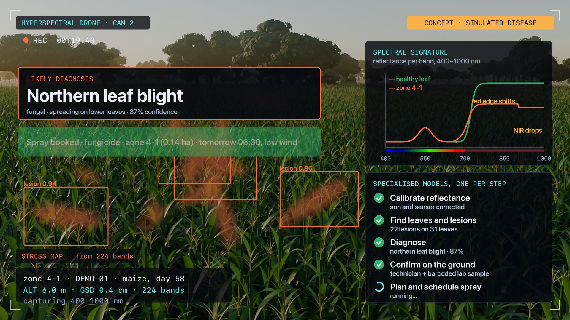
From a flagged zone to a booked spray
A concept film of the diagnosis step in development: stress map, spectral signature, diagnosis, confirmation and a zone-only spray. The disease and the spectral read are simulated.
Watch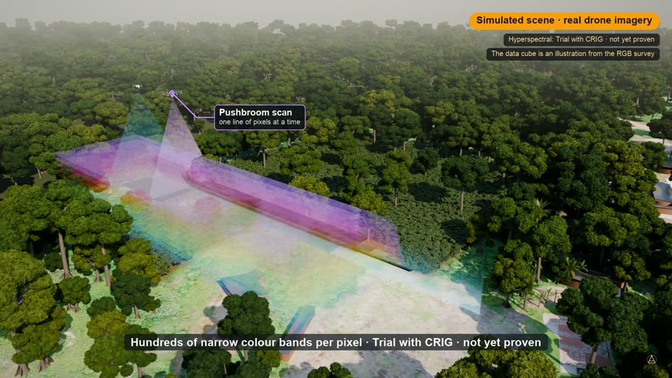
Finding cocoa swollen shoot before it spreads
A farmer's report, two drones, an AI first look at every cocoa crown, a technician and a lab test, then the farm treated and replanted with the farmer's agreement. Over real drone imagery, with voice-over.
WatchThe same engine, in every product
Flag, verify, then act is not a farm rule only. Every product keeps a person between what the AI sees and what is done about it. Six capabilities, each used where it fits.
Autonomy
Planning, routing and dispatch for machines that move, with a person approving the job first.
Where it is usedVision
Models that read cameras and aerial imagery and say what they see.
Where it is usedLive maps
Everything that moves on one map, with rules checked while it is moving.
Where it is usedIdentity and consent
People prove who they are once, and approve each share of their data.
Where it is usedForecasting
Models that plan ahead from the records a business already keeps.
Where it is usedDesign and 3D
A plan becomes a model you can walk through before anything is built.
Where it is usedDrone automation
Survey drones map a field zone by zone; a spray drone treats only the zone a technician confirmed.
Read moreOn-site AI
Segment, label and find-by-name models read 3 cm drone imagery on hardware at the hub, not in a cloud.
Read moreSatellite monitoring
Every field scored from 10 m satellite passes between drone flights, with an alert on a sharp drop.
Read moreGrow more on the same land
Stones, thickets and extra tracks found from the air and turned back into planted hectares, priced change by change.
Read morePut the engine to work with us
For partners, investors, government programmes and operators that want to run a pilot. Your message goes straight to the Aionautics team.